REmap
重新定义你的地图
Created by Chiffon郎大为
Supstat. Inc 数据科学家
地理信息的可视化
目的:
- 认识数据
- 展示数据
相关工具
- 商务工具: Tableau(Excel)
- GIS工具: ArcGIS
- 前端工具: Echarts.js D3.js,...
相关的R包
- 静态地理信息:
mapsggmapchoroplethr
- 交互地理信息:
leafletgoogleVis
- 辅助的R包:
RgoogleMaps,mapdata,mapproj,baidumap,...
静态化地图
maps- 最早的一批地理信息可视化
- US, world, china,...
library(maps)
library(mapdata)
data("chinaMapEnv")
map('china')

静态化地图
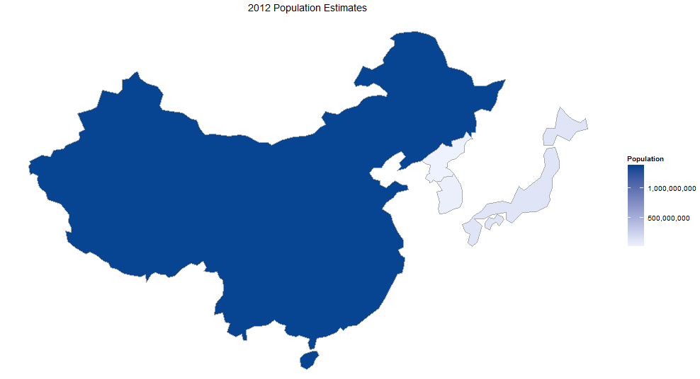
choroplethr- 海外很火的R包
library(choroplethr)
library(choroplethrMaps)
data(df_pop_country)
country_choropleth(df_pop_country,
                   title      = "2012 Population Estimates",
                   legend     = "Population",
                   num_colors = 1,
                   zoom       = c("china", "japan",
                                  "north korea","south korea"))
实时静态地图
ggmap
实时静态地图
- Sorry google
 http://nicpic.com
实时静态地图
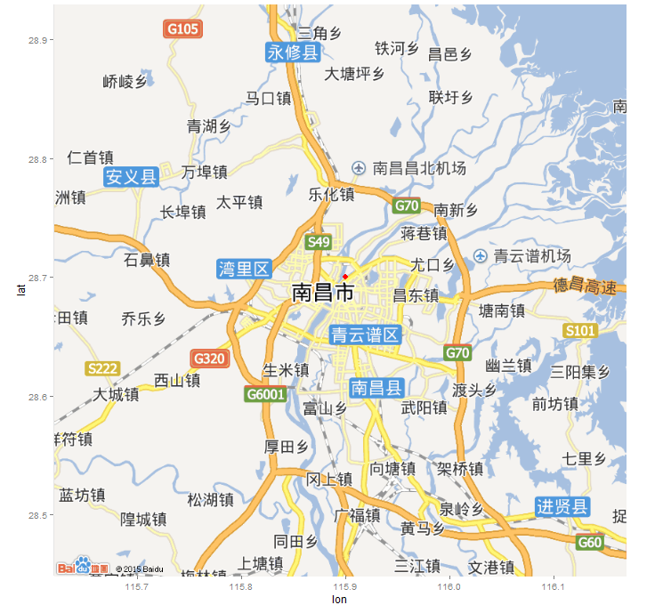
- HI baidu
- 与ggplot2结合
- 数据获取
devtools::install.github("badbye/baidumap")
library(baidumap)
p <- getBaiduMap('南昌') # the same
ggmap(p)+ geom_point(aes(x=115.9,y=28.7),size = 3,color='red')
可交互地图
leafletrecharts
library(leaflet)
m = leaflet() %>% addTiles()
m = m %>% setView(115.86453, 28.68767, zoom = 17)

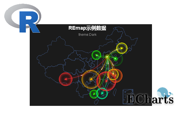
REmap
devtools::install_github('lchiffon/REmap')
library(REmap)
- 动态可交互地图
- 代码友好
- 解决常用的地图需求
- 期待更多的人接触Echarts
基本原理
- 使用R处理传入的数据
- 写出Javascript脚本(Echarts)
- 保存在临时的html文件中
- 调用浏览器展示
不需要的
- 不需要懂html
- 不需要懂Javascript/Echarts
需要的
- R
- Chorme或者Firefox作为默认浏览器
- UTF-8编码的数据框
分级统计图
- 使用颜色的深浅来展示数据
- 应用最广泛的地理位置可视化之一
| 省份 | GDP(亿元) |
|---|---|
| 北京 | 10578.28 |
| 天津 | 7884.04 |
| 河北 | 13798.13 |
| 上海 | 11887 |
| ... | ... |
数据来源: 中国统计年鉴2015年第二季度GDP
library(REmap)
GDP = read.csv("data/GDP.csv",encoding = "UTF-8")
remapC(GDP,
         color = c("red","yellow"),
         title = "2015年第二季度中国各省份GDP(亿元)",
         subtitle = "数据来源中国统计年鉴")

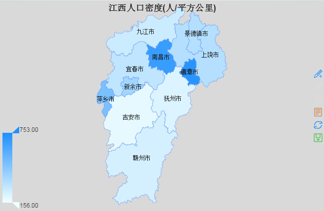
| city | space | population |
|---|---|---|
| 南昌市 | 7402.36 | 504.3 |
| 九江市 | 18823 | 485 |
| 上饶市 | 22791 | 740 |
| 抚州市 | 18817 | 400 |
| ... | ... | ... |
数据来源: http://baike.baidu.com
popu = read.csv("data/jiangxi.csv",encoding = "UTF-8")
plotdata = data.frame(city = popu$city,
                             density = popu$population/popu$space*1e4)
remapC(data = plotdata,maptype = "江西",
         title = "江西人口密度(人/平方公里)")
Bmap
| 出发点 | 到达点 |
|---|---|
| 北京 | 上海 |
| 北京 | 广州 |
| 北京 | 大连 |
| 北京 | 南宁 |
| ... | ... |
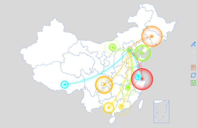
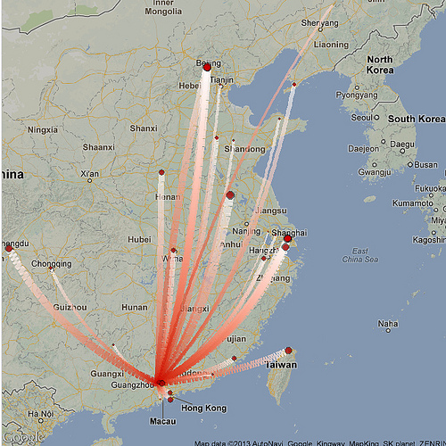
remap(demoC,theme = get_theme("Bright"))
remapB(markLineData = demoC,
         markPointData = demoC[,2])

# remapB(markLineData = demoC,
#        markPointData = demoC[,2],color = "Blue")


Bmap
城市级地图
## 获取线路
library(baidumap)
df = getRoute('南昌西站', '江西财经大学北区',region="南昌")
## 准备数据
df$label = paste("Point",1:dim(df)[1])
markLinedata = data.frame(origin = df$label[-dim(df)[1]],
                                  destination = df$label[-1])
## 绘制地图
remapB(center = get_city_coord("南昌"),
         zoom = 13,
         markLineData = markLinedata,geoData = df,
         markLineTheme = markLineControl(smoothness = 0,
                                                  effect = T,
                                                  symbolSize = c(0,0)))

## 获取数据
barbeque = getPlace('烧烤', '南昌')
## 准备数据
barbeque$tooltip = paste(barbeque$name,
                                 barbeque$address,
                                 barbeque$telephone,sep = "<br/>")
geodata = data.frame(barbeque$lon,
                            barbeque$lat,
                            barbeque$name)
## 绘制数据
remapB(center = get_city_coord("江西财经大学北区"),
         zoom = 15,
         markPointData = barbeque,
         geoData = geodata,
         markPointTheme = markPointControl(effect = F,symbol = "pin",
                                                     symbolSize = 7,
                                                     color="red"),
         title="南昌烧烤分布")

2015中国R语言会议
| place | name | time |
|---|---|---|
| 西安 | 2015数据与价值欧亚论坛暨R会议西安分论坛 | 2015年4月18日 |
| 广州 | 中国R语言(广州)会议-暨华南地区数据科学会议 | 2015年5月23-24日 |
| 北京 | 第八届中国R语言会议(北京) | 2015年6月6-7日 |
| ... | ... | ... |
数据来源: http://cos.name
## 读取数据
rCon = read.csv("data/R-con.csv",encoding = "UTF-8")
## 准备数据
rCon$pic = paste0("<img src=",rCon$pic," width=300px />")
plotdata = data.frame(place = rCon$place,
                             symbol = "image://./pic/cos.png",
                             tooltip = paste(rCon$name,rCon$time,rCon$pic,sep = "<br/>"))
## 绘制地图
remapC(data = chinaIphone,
         color = c("white","white"),
         markPointData = plotdata,
         markPointTheme = markPointControl(effect = F,
                                                     symbolSize = 30),
         title = "2015中国R语言会议"
         )

最早的数据产品
什么算一个数据产品
- 数据驱动
- 建模预测
- 较好的可视化来展示结果
天气预报
- 数据驱动
- 建模预测
- 较好的可视化来展示结果
- 如果能更准确点...
cityvec = c("上海",
            "广州","大连","南宁","南昌","拉萨","长春","包头",
            "重庆","武汉","北京","洛阳","台北","乌鲁木齐","沈阳",
            "西安","成都","合肥","长沙","济南","福州","兰州")
weather = sapply(cityvec,get_weather_str)
plotdata = data.frame(cityvec,
                      tooltip=paste0(cityvec,weather[1,]),
                      symbol = weather[2,])
remapB(markPointData = plotdata,
       markPointTheme = markPointControl(symbolSize = 25,
                                         effect = F),
       color = "Blue",
       title = "未来天气预报",
       subtitle = "by REmap, Chiffon")

美好的未来


七风阁

REmap主页

雪晴网

Thanks
Q&A
- 微博@郎大为Chiffon
